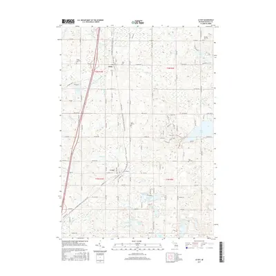
2017 Map of Le Roy
USGS Topo · Published 2017About this map
Tustin and Le Roy anchor this portion of Osceola County, following the north-south corridor of the former rail line now preserved as the Fred Meijer White Pine Trail State Park. This transit spine, once the backbone of the region's timber and agricultural economy, connects these communities across a landscape punctuated by glacial water bodies. The geography is defined by a dense network of lakes and creeks, including Diamond Lake and Rose Lake, which feed systems like the Diamond Lake Outlet Cr and Beaver Cr. Local heritage is preserved in several rural burial grounds such as Maple Hill Cem and Burdell Township Cem. The presence of the Osceola Ledge near Rose Lake suggests the subtle elevation changes that characterize this upland Michigan terrain, where small-town street grids give way to an extensive network of county roads.
Find a feature on this map
112 named features on this map. Tap any name to fly to it.
Don’t see what you’re looking for? This feature index may not catch every label — zoom into the map to look around manually.
Map Details
Editions of this 2017 Le Roy Map
This is the sole edition of this map. No revisions or reprints were ever made.
Other maps of this area

1931 · Chase NE
USGS Topo · 1:31,680

1933 · Luther SE
USGS Topo · 1:31,680

1954 · Traverse City
USGS Topo · 1:250,000

1954 · Midland
USGS Topo · 1:250,000

1957 · Cadillac South
USGS Topo · 1:62,500

1957 · Luther
USGS Topo · 1:62,500

1958 · Traverse City
USGS Topo · 1:250,000

1958 · Midland
USGS Topo · 1:250,000

1959 · Midland
USGS Topo · 1:250,000

1959 · Evart
USGS Topo · 1:62,500