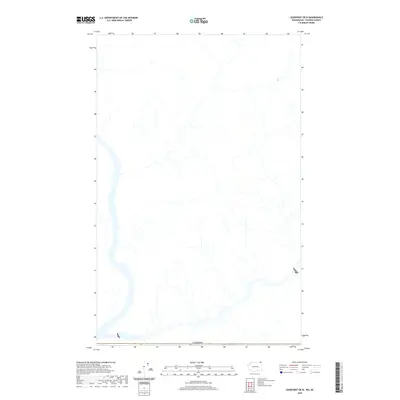
2020 Map of Leadpoint OE N
USGS Topo · Published 2020About this map
This remote northern landscape is defined by the international boundary along the northern edge of Washington State, where the Canada border separates Stevens County from the Salmo Valley region. The area is characterized by an intricate drainage network of creeks and tributaries that feed into larger water bodies. This 2020 edition was produced by the U.S. Geological Survey using the National Hydrography Dataset and National Elevation Dataset to provide a clear view of the complex terrain and wetlands. While no towns or roads are named on this specific sheet, the map provides an essential look at the natural hydrology and topographical contours of this borderland area just north of Leadpoint.
Find a feature on this map
1 named feature on this map. Tap any name to fly to it.
Don’t see what you’re looking for? This feature index may not catch every label — zoom into the map to look around manually.
Map Details
Editions of this 2020 Leadpoint OE N Map
This is the sole edition of this map. No revisions or reprints were ever made.
Other maps of this area

1929 · Colville
USGS Topo · 1:125,000

1933 · Colville
USGS Topo · 1:125,000

1934 · Metaline
USGS Topo · 1:125,000

1942 · Metaline
USGS Topo · 1:125,000

1952 · Leadpoint
USGS Topo · 1:24,000

1952 · Boundary
USGS Topo · 1:24,000

1958 · Sandpoint
USGS Topo · 1:250,000

1963 · Sandpoint
USGS Topo · 1:250,000
1967 · Abercrombie Mtn
USGS Topo · 1:24,000
1984 · Colville
USGS Topo · 1:100,000