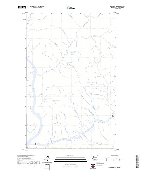
2023 Map of Leadpoint OE N
USGS Topo · Published 2023About this map
The confluence of the Columbia River and the Pend-d'Oreille River dominates this northern Stevens County landscape, recorded in the early 21st century. This area is characterized by a dense network of mountain drainages, where multiple named tributaries flow from the high ground toward these major river systems. On the western side, Sheppard Creek, Sayward Creek, and Casino Creek feed directly into the Columbia, while the southern portion of the map is defined by the winding course of the Pend-d'Oreille River as it receives Bearskin Creek and Lime Creek. The map provides a look at the hydrography of the region, including smaller upper-elevation streams like Fruitvale Creek, Wyngill Creek, and Kelly Creek in the north. This survey documents the natural waterways of the Pacific Northwest hinterland, marking the vital paths where mountain snowmelt descends toward the primary regional basins.
Find a feature on this map
20 named features on this map. Tap any name to fly to it.
Don’t see what you’re looking for? This feature index may not catch every label — zoom into the map to look around manually.
Map Details
Editions of this 2023 Leadpoint OE N Map
This is the sole edition of this map. No revisions or reprints were ever made.
Other maps of this area

1929 · Colville
USGS Topo · 1:125,000

1933 · Colville
USGS Topo · 1:125,000

1934 · Metaline
USGS Topo · 1:125,000

1942 · Metaline
USGS Topo · 1:125,000

1952 · Leadpoint
USGS Topo · 1:24,000

1952 · Boundary
USGS Topo · 1:24,000

1958 · Sandpoint
USGS Topo · 1:250,000

1963 · Sandpoint
USGS Topo · 1:250,000
1967 · Abercrombie Mtn
USGS Topo · 1:24,000
1984 · Colville
USGS Topo · 1:100,000