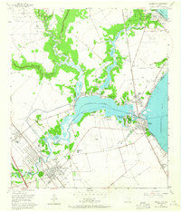
1955 Map of League City
USGS Topo · Published 1964About this map
The coastal landscapes of Galveston Bay meet the developing waterfront communities of League City and Seabrook in this mid-century survey. The geography is defined by the convergence of Clear Lake, Taylor Lake, and Clear Creek, creating a complex network of bayous and sloughs that dictated early settlement patterns. Transportation infrastructure is prominent, featuring the Galveston Houston and Henderson railroad and the burgeoning Gulf Freeway. Local life is anchored by landmarks like the Camp Meeting Gd and the Fairview Cem near the League City townsite. The industrial footprint of the era is evident through the Clear Lake Oil Field and various Gravel Pits, while the region's transition into a recreational and residential hub is signaled by the Yacht Basin and established neighborhoods like Shoreacres and Kemah.
Find a feature on this map
49 named features on this map. Tap any name to fly to it.
Don’t see what you’re looking for? This feature index may not catch every label — zoom into the map to look around manually.
Map Details
Editions of this 1955 League City Map
Other maps of this area

1915 · Deepwater
USGS Topo · 1:24,000

1916 · Genoa
USGS Topo · 1:24,000

1916 · Morgan Point
USGS Topo · 1:24,000

1916 · Seabrook
USGS Topo · 1:24,000

1916 · La Porte
USGS Topo · 1:24,000

1919 · Morgan Point
USGS Topo · 1:31,680

1919 · Deepwater
USGS Topo · 1:31,680

1920 · Seabrook
USGS Topo · 1:31,680

1920 · Genoa
USGS Topo · 1:31,680

1920 · La Porte
USGS Topo · 1:31,680