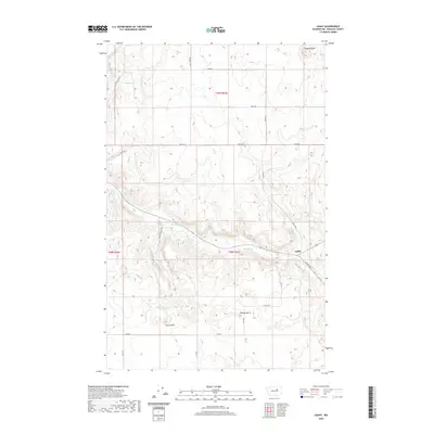
2020 Map of Leahy
USGS Topo · Published 2020About this map
Leahy sits at the convergence of several rural routes in the heart of Douglas County, where the landscape is defined by the winding course of E Foster Cr and Deep Cr. This topographic study reveals a high-plateau environment marked by prominent elevations such as Ragged Butte, Spiva Butte, and Reaves Butte. The map details the vital water sources for this arid region, including Tinker Spring, Badger Spring, and the isolated Tinker Lake. A network of unpaved roads, such as Chalk Hills Rd Ne and Terry Hayes Rd Ne, connects the scattered range lands, reflecting the enduring agricultural and ranching character of the northern Washington interior. The grid-like survey lines highlight the vastness of the township and range divisions across this sparsely populated territory.
Find a feature on this map
25 named features on this map. Tap any name to fly to it.
Don’t see what you’re looking for? This feature index may not catch every label — zoom into the map to look around manually.
Map Details
Editions of this 2020 Leahy Map
This is the sole edition of this map. No revisions or reprints were ever made.
Other maps of this area

1905 · Okanogan
USGS Topo · 1:125,000

1950 · Boot Mtn
USGS Topo · 1:62,500

1953 · Ritzville
USGS Topo · 1:250,000

1954 · Okanogan
USGS Topo · 1:250,000

1957 · Bridgeport
USGS Topo · 1:62,500

1958 · Okanogan
USGS Topo · 1:250,000

1959 · Ritzville
USGS Topo · 1:250,000

1965 · Ritzville
USGS Topo · 1:250,000

1968 · Coleman Hill
USGS Topo · 1:24,000
1968 · Barnes Butte
USGS Topo · 1:24,000