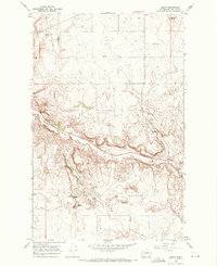
1968 Map of Leahy
USGS Topo · Published 1971About this map
Leahy sits at the junction of coulees in the high plateau country of Douglas County during the late 1960s. This agricultural and rangeland landscape is defined by its water sources and prominent geological markers, including Ragged Butte and Spiva Butte. The drainage of East Foster Creek carves a significant path through the center of the sheet, joined by Deep Creek amidst a network of springs such as Badger Spring and Tinker Spring. The land use of the era is evidenced by several Borrow Pit locations and a Gravel Pit, likely supporting the rural road infrastructure connecting these isolated landmarks. Numerous elevation benchmarks, such as BM 1940, indicate the precise geodetic work conducted to document this section of the Columbia Plateau's complex topography.
Find a feature on this map
19 named features on this map. Tap any name to fly to it.
Don’t see what you’re looking for? This feature index may not catch every label — zoom into the map to look around manually.
Map Details
Editions of this 1968 Leahy Map
This is the sole edition of this map. No revisions or reprints were ever made.
Other maps of this area

1905 · Okanogan
USGS Topo · 1:125,000

1950 · Boot Mtn
USGS Topo · 1:62,500

1953 · Ritzville
USGS Topo · 1:250,000

1954 · Okanogan
USGS Topo · 1:250,000

1957 · Bridgeport
USGS Topo · 1:62,500

1958 · Okanogan
USGS Topo · 1:250,000

1959 · Ritzville
USGS Topo · 1:250,000

1965 · Ritzville
USGS Topo · 1:250,000

1968 · Coleman Hill
USGS Topo · 1:24,000
1968 · Barnes Butte
USGS Topo · 1:24,000