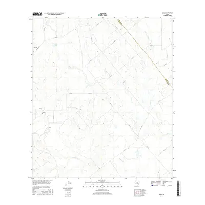
2016 Map of Leal
USGS Topo · Published 2016About this map
The Leal settlement and its nearby Leal Cem anchor this South Texas landscape, situated along the meandering path of the Atascosa River. This 2016 survey illustrates a rural terrain defined by intricate drainage systems and ranching infrastructure, where water sources like Heinen Lake and Lazy JP Ranch Lake serve the surrounding cattle country. The map clearly delineates the border between Wilson and Atascosa counties, which cuts diagonally through a network of creeks including Prieto Cr, Borrego Cr, and Buckhorn Cr. The road network is a mix of established farm-to-market routes like FM 541 and FM 478, alongside numerous local connectors such as Lucas Rd and Jim Bright Rd, reflecting the modern agricultural and residential layout of this quiet corner of the Brush Country.
Find a feature on this map
35 named features on this map. Tap any name to fly to it.
Don’t see what you’re looking for? This feature index may not catch every label — zoom into the map to look around manually.
Map Details
Editions of this 2016 Leal Map
This is the sole edition of this map. No revisions or reprints were ever made.
Other maps of this area

1931 · Falls City
USGS Topo · 1:62,500

1936 · Floresville
USGS Topo · 1:62,500

1953 · Crystal City
USGS Topo · 1:250,000

1954 · San Antonio
USGS Topo · 1:250,000

1955 · Crystal City
USGS Topo · 1:250,000

1956 · Pleasanton
USGS Topo · 1:62,500

1957 · San Antonio
USGS Topo · 1:250,000

1961 · Crystal City
USGS Topo · 1:250,000
1961 · Dewees
USGS Topo · 1:24,000
1961 · Three Oaks
USGS Topo · 1:24,000