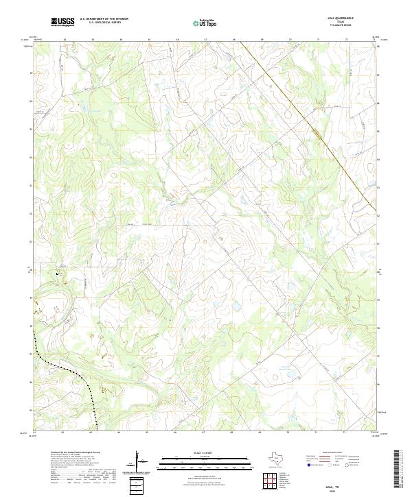
2022 Map of Leal
USGS Topo · Published 2022About this map
The Atascosa River winds through this landscape on the border of Wilson and Atascosa counties, defining the southern portion of the survey. Significant water features such as Heinen Lake and Lazy JP Ranch Lake suggest a terrain marked by ranching and local water management. The road network is primarily composed of rural routes and farm-to-market roads, including FM 541 and FM 478, which connect isolated homesteads and ranch properties. Genealogists and local historians will find the Leal Cem a primary point of interest, located near the intersection of Leal Rd and Jim Bright Rd. The drainage system is clearly articulated through a series of creeks, most notably Lucas Cr, Prieto Cr, and Borrego Cr, which feed into the primary river basin. This data provides a detailed view of contemporary land divisions and the hydrologic character of the South Texas brush country.
Find a feature on this map
34 named features on this map. Tap any name to fly to it.
Don’t see what you’re looking for? This feature index may not catch every label — zoom into the map to look around manually.
Map Details
Editions of this 2022 Leal Map
This is the sole edition of this map. No revisions or reprints were ever made.
Other maps of this area

1931 · Falls City
USGS Topo · 1:62,500

1936 · Floresville
USGS Topo · 1:62,500

1953 · Crystal City
USGS Topo · 1:250,000

1954 · San Antonio
USGS Topo · 1:250,000

1955 · Crystal City
USGS Topo · 1:250,000

1956 · Pleasanton
USGS Topo · 1:62,500

1957 · San Antonio
USGS Topo · 1:250,000

1961 · Crystal City
USGS Topo · 1:250,000
1961 · Dewees
USGS Topo · 1:24,000
1961 · Three Oaks
USGS Topo · 1:24,000