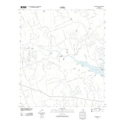
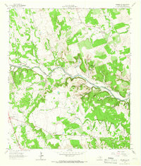
2010 Map of Leander NE
USGS Topo · Published 2010About this map
The Middle Fork San Gabriel River and the North Fork San Gabriel River dominate this Central Texas landscape near Georgetown, converging as they flow into North Fork Lake. The terrain is characterized by a series of deep hollows and ridges, such as Morrison Ridge and Bullion Hollow, which have historically dictated the placement of roads and early homesteads. Traces of early settlement are evident in the numerous family cemeteries scattered across the quadrangle, including the Fore Cemetery, Hunt Cemetery, and Sawyer Cemetery. Landmarks like Rock House and the river-based Hunt Crossing suggest a history of localized rural life and water-dependent travel. The area's transition into more modern development is reflected in the residential street patterns of Crockett Gardens and the inclusion of private aviation sites like Hilde-Griff Field.
Find a feature on this map
80 named features on this map. Tap any name to fly to it.
Don’t see what you’re looking for? This feature index may not catch every label — zoom into the map to look around manually.
Map Details
Editions of this 2010 Leander NE Map
This is the sole edition of this map. No revisions or reprints were ever made.
Other maps of this area

1893 · Georgetown
USGS Topo · 1:125,000

1925 · Georgetown 4-b
USGS Topo · 1:48,000

1928 · Round Rock
USGS Topo · 1:62,500

1949 · Round Rock
USGS Topo · 1:62,500

1951 · Round Rock
USGS Topo · 1:62,500

1954 · Austin
USGS Topo · 1:250,000
1962 · Liberty Hill
USGS Topo · 1:24,000
1962 · Leander
USGS Topo · 1:24,000
1962 · Nameless
USGS Topo · 1:24,000
1962 · Leander NE
USGS Topo · 1:24,000