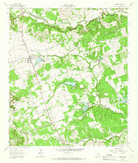
1962 Map of Leander
USGS Topo · Published 1966About this map
The Southern Pacific railroad corridor anchors the early 1960s development of the Hill Country fringe, linking the established community of Leander with the emerging settlement of Cedar Park to the south. This era shows a landscape in transition, where family-named landmarks like Davis Cem and Bonner Cem remain central to the rural identity while industrial Quarry and Gravel Pits operations indicate a growing reliance on the local limestone and aggregate resources.
Find a feature on this map
32 named features on this map. Tap any name to fly to it.
Don’t see what you’re looking for? This feature index may not catch every label — zoom into the map to look around manually.
Map Details
Editions of this 1962 Leander Map
4 editions found
Other maps of this area

1893 · Georgetown
USGS Topo · 1:125,000

1896 · Austin
USGS Topo · 1:125,000

1897 · Austin
USGS Topo · 1:125,000

1910 · Austin
USGS Topo · 1:125,000

1925 · Georgetown 4-b
USGS Topo · 1:48,000

1928 · Round Rock
USGS Topo · 1:62,500

1930 · Austin-2
USGS Topo · 1:48,000

1932 · Mt. Bonnell
USGS Topo · 1:62,500

1949 · Round Rock
USGS Topo · 1:62,500

1951 · Round Rock
USGS Topo · 1:62,500