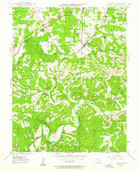
1948 Map of Leasburg
USGS Topo · Published 1962About this map
The St Louis San Francisco railroad cuts a diagonal path across this northern Ozark landscape, anchoring the village of Leasburg and the smaller junctions of Hofflins and Coffeyton. This mid-century survey captures a rural Crawford County community defined by its water sources and scattered institutions. The Meramec River winds through the southern half of the quadrangle, joined by the spring-fed waters of McKee Spring and Saranac Spring. This river-and-rail geography supported a network of small schoolhouses and churches that served the agricultural workforce of Benton and Liberty townships.
Find a feature on this map
32 named features on this map. Tap any name to fly to it.
Don’t see what you’re looking for? This feature index may not catch every label — zoom into the map to look around manually.
Map Details
Editions of this 1948 Leasburg Map
5 editions found
Other maps of this area

1903 · Sullivan
USGS Topo · 1:125,000

1932 · Steelville
USGS Topo · 1:48,000

1933 · Steelville
USGS Topo · 1:62,500

1937 · Steelville
USGS Topo · 1:62,500

1943 · Berryman
USGS Topo · 1:62,500

1945 · Berryman
USGS Topo · 1:62,500

1947 · Sullivan
USGS Topo · 1:62,500

1948 · Cuba
USGS Topo · 1:24,000

1948 · Leasburg
USGS Topo · 1:24,000

1948 · Argo
USGS Topo · 1:24,000