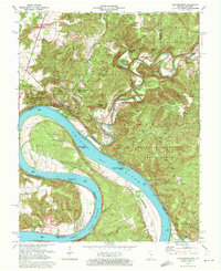
1970 Map of Leavenworth
USGS Topo · Published 1976About this map
The Ohio River dominates this landscape at the border of Indiana and Kentucky, carving dramatic curves through the region including Big Bend and Oxbow Bend. The settlement of Leavenworth is situated on the heights overlooking the water, while the label for Old Leavenworth down by the river bank signifies the town's relocation to higher ground following historic flooding. This transition is further evidenced by the Proposed Location of new infrastructure on the bluffs.
Find a feature on this map
50 named features on this map. Tap any name to fly to it.
Don’t see what you’re looking for? This feature index may not catch every label — zoom into the map to look around manually.
Map Details
Editions of this 1970 Leavenworth Map
Other maps of this area

1931 · Corydon
USGS Topo · 1:62,500

1944 · Corydon West
USGS Topo · 1:24,000

1946 · Leavenworth
USGS Topo · 1:24,000

1946 · Depauw
USGS Topo · 1:24,000

1947 · Leavenworth
USGS Topo · 1:24,000

1947 · Corydon West
USGS Topo · 1:24,000

1947 · Mauckport
USGS Topo · 1:24,000

1948 · Milltown
USGS Topo · 1:24,000

1950 · Beechwood
USGS Topo · 1:24,000

1950 · English
USGS Topo · 1:24,000