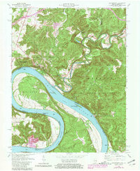
1970 Map of Leavenworth
USGS Topo · Published 1981About this map
The Ohio River dominates this landscape as it carves massive loops through the terrain at Oxbow Bend and Big Bend. Along the Indiana shore, the town of Leavenworth serves as a primary settlement, situated near the confluence where the Blue River meets the Ohio. This area is heavily defined by the Harrison-Crawford State Forest, which blankets the high ridges and deep hollows like Friday Hollow and Cedar Branch Hollow.
Find a feature on this map
48 named features on this map. Tap any name to fly to it.
Don’t see what you’re looking for? This feature index may not catch every label — zoom into the map to look around manually.
Map Details
Editions of this 1970 Leavenworth Map
Other maps of this area

1931 · Corydon
USGS Topo · 1:62,500

1944 · Corydon West
USGS Topo · 1:24,000

1946 · Leavenworth
USGS Topo · 1:24,000

1946 · Depauw
USGS Topo · 1:24,000

1947 · Leavenworth
USGS Topo · 1:24,000

1947 · Corydon West
USGS Topo · 1:24,000

1947 · Mauckport
USGS Topo · 1:24,000

1948 · Milltown
USGS Topo · 1:24,000

1950 · Beechwood
USGS Topo · 1:24,000

1950 · English
USGS Topo · 1:24,000