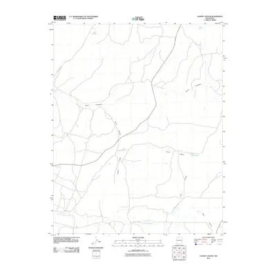
2010 Map of Leavry Canyon
USGS Topo · Published 2010About this map
Leavry Canyon carves a central path through this section of Rio Arriba County, defining a landscape shaped by seasonal watercourses and high-desert drainage patterns. The topography is anchored by Tapicito Ridge, which separates the canyon from the southern flow of Tapicito Creek. Several significant water catchment features are identified, including the distinct Lower Leavry Pond and Upper Leavry Pond, which likely serve as vital resources in this arid environment.
Find a feature on this map
12 named features on this map. Tap any name to fly to it.
Don’t see what you’re looking for? This feature index may not catch every label — zoom into the map to look around manually.
Map Details
Editions of this 2010 Leavry Canyon Map
This is the sole edition of this map. No revisions or reprints were ever made.
Other maps of this area

1889 · Largo
USGS Topo · 1:250,000

1895 · Largo
USGS Topo · 1:250,000

1909 · Gallina
USGS Topo · 1:125,000

1954 · Aztec
USGS Topo · 1:250,000

1955 · Llaves
USGS Topo · 1:62,500

1955 · Boulder Lake
USGS Topo · 1:62,500

1958 · Aztec
USGS Topo · 1:250,000

1962 · Aztec
USGS Topo · 1:250,000

1963 · Schmitz Ranch
USGS Topo · 1:24,000
1963 · Ojito
USGS Topo · 1:24,000