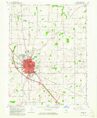
1963 Map of Lebanon
USGS Topo · Published 1965About this map
The county seat of Lebanon serves as the focal point of this 1963 survey, reflecting a period of post-war growth in Boone County. The city layout is exceptionally detailed, featuring essential community landmarks such as Witham Hospital, the local Armory, and multiple educational institutions including Harney Sch and St Josephs Sch. Surrounding the urban center are established residential enclaves like Ulen and Brendan Wood, while the New York Central Railroad corridor cuts diagonally across the landscape, underscoring the region's importance as a transportation hub.
Find a feature on this map
99 named features on this map. Tap any name to fly to it.
Don’t see what you’re looking for? This feature index may not catch every label — zoom into the map to look around manually.
Map Details
Editions of this 1963 Lebanon Map
3 editions found
Other maps of this area

1953 · Fayette
USGS Topo · 1:24,000

1953 · Rosston
USGS Topo · 1:24,000

1953 · Lizton
USGS Topo · 1:24,000

1953 · Zionsville
USGS Topo · 1:24,000

1953 · Lebanon
USGS Topo · 1:24,000

1953 · Danville
USGS Topo · 1:250,000

1953 · Indianapolis
USGS Topo · 1:250,000

1955 · Danville
USGS Topo · 1:250,000

1956 · Danville
USGS Topo · 1:250,000

1956 · Indianapolis
USGS Topo · 1:250,000