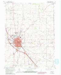
1963 Map of Lebanon
USGS Topo · Published 1980About this map
Lebanon serves as the central hub of this Boone County landscape, showing the town's mid-century footprint alongside expansion into neighboring Ulen and Brendan Wood. The map documents a community deeply rooted in its local institutions, from the Witham Hospital and High School to the Municipal Bldg downtown. Transportation patterns are defined by the Conrail line and a dense network of numbered county roads that follow the township boundaries of Washington, Clinton, Center, and Worth.
Find a feature on this map
87 named features on this map. Tap any name to fly to it.
Don’t see what you’re looking for? This feature index may not catch every label — zoom into the map to look around manually.
Map Details
Editions of this 1963 Lebanon Map
3 editions found
Other maps of this area

1953 · Fayette
USGS Topo · 1:24,000

1953 · Rosston
USGS Topo · 1:24,000

1953 · Lizton
USGS Topo · 1:24,000

1953 · Zionsville
USGS Topo · 1:24,000

1953 · Lebanon
USGS Topo · 1:24,000

1953 · Danville
USGS Topo · 1:250,000

1953 · Indianapolis
USGS Topo · 1:250,000

1955 · Danville
USGS Topo · 1:250,000

1956 · Danville
USGS Topo · 1:250,000

1956 · Indianapolis
USGS Topo · 1:250,000