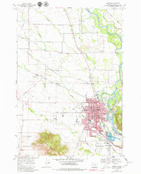
1969 Map of Lebanon
USGS Topo · Published 1979About this map
The South Santiam River anchors this 1969 survey of Lebanon and its surrounding Willamette Valley landscape. The city center is a dense network of civic and social life, featuring City Hall, the Post Office, and Community Hospital alongside several historic burial grounds like IOOF Cem and Pioneer Cem. The surrounding plains are heavily defined by the movement of water and commerce, from the Little Santiam Canal and Marika Slough to the prominent routes of the Southern Pacific and Oregon Electric Pacific railroads.
Find a feature on this map
55 named features on this map. Tap any name to fly to it.
Don’t see what you’re looking for? This feature index may not catch every label — zoom into the map to look around manually.
Map Details
Editions of this 1969 Lebanon Map
3 editions found
Other maps of this area

1911 · Brownsville
USGS Topo · 1:31,680

1911 · Lebanon
USGS Topo · 1:31,680

1911 · Tangent
USGS Topo · 1:31,680

1912 · Jefferson
USGS Topo · 1:31,680

1912 · Halsey
USGS Topo · 1:62,500

1916 · Albany
USGS Topo · 1:62,500

1921 · Brownsville
USGS Topo · 1:62,500

1921 · Lebanon
USGS Topo · 1:62,500

1922 · Lebanon
USGS Topo · 1:48,000

1924 · Lebanon
USGS Topo · 1:62,500