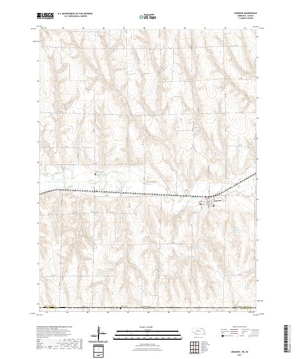
2021 Map of Lebanon
USGS Topo · Published 2021About this map
Lebanon serves as the primary settlement hub in this portion of Red Willow County, positioned along the banks of Beaver Cr. The landscape is defined by the organized grid of the Public Land Survey System, which dictates the placement of rural roads like RD 704 and RD 707. This 2021 edition documents the critical water management infrastructure of the high plains, showing several significant impoundments including Halsey Reservoir, Haag Reservoir, and Matheny Reservoir. Local history is anchored by several burial grounds situated on the plateaus above the creek valley, such as Hamburg Cem to the northwest and Lebanon Cem near the town center. The southern margin tracks the state boundary where Red Willow Co, Nebraska, meets Decatur Co, Kansas, marked by Co RD 495 and the nearby Redman Cem.
Find a feature on this map
31 named features on this map. Tap any name to fly to it.
Don’t see what you’re looking for? This feature index may not catch every label — zoom into the map to look around manually.
Map Details
Editions of this 2021 Lebanon Map
This is the sole edition of this map. No revisions or reprints were ever made.
Other maps of this area

1951 · Norcatur
USGS Topo · 1:62,500

1951 · Kanona
USGS Topo · 1:62,500

1954 · McCook
USGS Topo · 1:250,000

1954 · Goodland
USGS Topo · 1:250,000

1956 · Goodland
USGS Topo · 1:250,000

1957 · McCook
USGS Topo · 1:250,000

1957 · Goodland
USGS Topo · 1:250,000

1957 · Shippee
USGS Topo · 1:24,000

1957 · Danbury
USGS Topo · 1:24,000

1957 · Lebanon
USGS Topo · 1:24,000