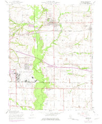
1954 Map of Lebanon
USGS Topo · Published 1975About this map
McKendree College and the town of Lebanon anchor this St. Clair County landscape, which reflects a blend of historic collegiate life and mid-century military expansion. The eastern edge of Scott Air Force Base dominates the southwestern quadrant, showing the significant footprint of the installation as it stood during the Cold War era. To the east, the settlement of Summerfield is situated along the Baltimore and Ohio railroad line, while the southern reaches are marked by the industrial presence of the Southern railroad and Mascoutah Lake.
Find a feature on this map
38 named features on this map. Tap any name to fly to it.
Don’t see what you’re looking for? This feature index may not catch every label — zoom into the map to look around manually.
Map Details
Editions of this 1954 Lebanon Map
4 editions found
Other maps of this area

1906 · Breese
USGS Topo · 1:62,500

1907 · Breese
USGS Topo · 1:62,500

1907 · Belleville
USGS Topo · 1:62,500

1910 · Okawville
USGS Topo · 1:62,500

1912 · New Athens
USGS Topo · 1:62,500

1935 · Lebanon
USGS Topo · 1:24,000

1937 · Collinsville
USGS Topo · 1:24,000

1937 · O'Fallon
USGS Topo · 1:24,000

1940 · Okawville
USGS Topo · 1:62,500

1949 · Lebanon
USGS Topo · 1:24,000