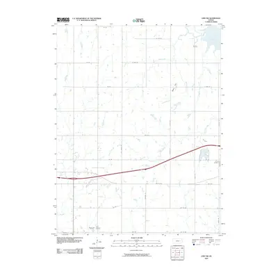
2009 Map of Lebo NW
USGS Topo · Published 2009About this map
Melvern Lake dominates the northeast corner of this Kansas landscape, where the waters meet the prairie terrain of Coffey County. The region is defined by a dendritic network of waterways, including Puleston Creek and Winnifred Creek, which carve through the land surrounding Bebo Hill. This area preserves several traditional burial grounds that serve as vital links for local genealogy, such as the Arvonia Cemetery near the lake and the Lincoln Cemetery further south. A dense grid of rural roads, including Angus Rd and Contour Rd, connects these scattered landmarks and farmsteads. Near the southern boundary, the Saint Lawrence Cemetery and Mount Hope Cemetery sit in close proximity, marking long-standing community sites in this agricultural corridor near Lebo Creek.
Find a feature on this map
37 named features on this map. Tap any name to fly to it.
Don’t see what you’re looking for? This feature index may not catch every label — zoom into the map to look around manually.
Map Details
Editions of this 2009 Lebo NW Map
This is the sole edition of this map. No revisions or reprints were ever made.
Other maps of this area

1885 · Eskridge
USGS Topo · 1:125,000

1885 · Burlington
USGS Topo · 1:125,000

1888 · Emporia
USGS Topo · 1:125,000

1889 · Burlingame
USGS Topo · 1:125,000

1889 · Eskridge
USGS Topo · 1:125,000

1894 · Emporia
USGS Topo · 1:125,000

1894 · Eskridge
USGS Topo · 1:125,000

1894 · Burlingame
USGS Topo · 1:125,000

1894 · Burlington
USGS Topo · 1:125,000

1947 · Lawrence
USGS Topo · 1:250,000