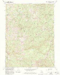
1966 Map of Leech Lake Mtn.
USGS Topo · Published 1994About this map
The Middle Fork Eel River carves through a landscape of high ridges and isolated outposts in the Yolla Bolly Middle Eel Wilderness and Mendocino National Forest. This 1966 survey, updated with late-1980s data, documents a remote network of pack trails and family-named landmarks like Asa Bean Crossing and Foster Glades. The map highlights the intersection of human activity and natural boundaries, noting the site of Osborn Station (Site) and the high elevation of Leech Lake Mtn.
Find a feature on this map
61 named features on this map. Tap any name to fly to it.
Don’t see what you’re looking for? This feature index may not catch every label — zoom into the map to look around manually.
Map Details
Editions of this 1966 Leech Lake Mtn. Map
3 editions found
Other maps of this area

1890 · Red Bluff
USGS Topo · 1:250,000

1894 · Red Bluff
USGS Topo · 1:250,000

1926 · Covelo
USGS Topo · 1:62,500

1931 · Hoaglin
USGS Topo · 1:96,000

1935 · Hoaglin
USGS Topo · 1:125,000

1952 · Covelo
USGS Topo · 1:62,500

1952 · Anthony Peak
USGS Topo · 1:62,500

1953 · Blackrock Mtn
USGS Topo · 1:62,500

1954 · Blackrock Mtn
USGS Topo · 1:62,500

1954 · Yolla Bolly
USGS Topo · 1:62,500