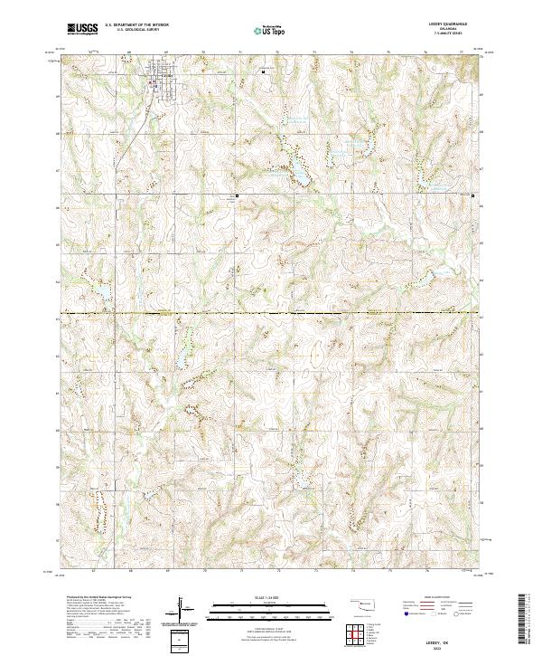
2022 Map of Leedey
USGS Topo · Published 2022About this map
Leedey serves as the focal point of this western Oklahoma landscape, situated just north of the Dewey Co Custer Co line. The town's grid is clearly defined by residential streets such as Phillips Ave, Evans Ave, and Schley Ave, with S Main St anchoring the commercial corridor. Beyond the town limits, the terrain is characterized by a complex drainage network feeding into Wild Horse Creek and the North Branch Quartermaster Creek, reflecting a region shaped by agricultural water management. Numerous reservoirs, including the Barnitz Creek Site 1a Reservoir and Barnitz Creek Site 5 Reservoir, are scattered throughout the sections, underscoring the importance of irrigation and conservation in these prairie uplands. Small rural burial grounds like Evergreen Cemetery and New Hermon Cemetery offer significant touchstones for local genealogical research.
Find a feature on this map
46 named features on this map. Tap any name to fly to it.
Don’t see what you’re looking for? This feature index may not catch every label — zoom into the map to look around manually.
Map Details
Editions of this 2022 Leedey Map
This is the sole edition of this map. No revisions or reprints were ever made.
Other maps of this area

1955 · Clinton
USGS Topo · 1:250,000

1957 · Clinton
USGS Topo · 1:250,000

1957 · Butler
USGS Topo · 1:62,500

1960 · Hammon
USGS Topo · 1:62,500

1961 · Leedey
USGS Topo · 1:62,500

1962 · Aledo
USGS Topo · 1:62,500

1976 · Butler NW
USGS Topo · 1:24,000
1983 · Butler
USGS Topo · 1:24,000

1984 · Foss Reservoir
USGS Topo · 1:100,000
1984 · Rhea
USGS Topo · 1:24,000