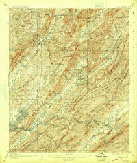
1907 Map of Leeds
USGS Topo · Published 1924About this map
The industrial and transport corridors of the Birmingham Coal District define this early 20th-century landscape, where heavy industry and mountain ridges converge. This survey documents the critical infrastructure of the era, notably the Lady Belle Furnace near Trussville and Alreds Mines situated south of Pinson PO. The map reveals a dense network of competing railroads, including the Southern, Seaboard Airline, and the Louisville and Nashville, which facilitated the movement of coal and iron across the ridge-and-valley topography of Sand Mountain and Red Mountain.
Find a feature on this map
70 named features on this map. Tap any name to fly to it.
Don’t see what you’re looking for? This feature index may not catch every label — zoom into the map to look around manually.
Map Details
Editions of this 1907 Leeds Map
3 editions found

Other maps of this area

1889 · Springville
USGS Topo · 1:125,000

1889 · Birmingham
USGS Topo · 1:125,000

1890 · Bessemer
USGS Topo · 1:125,000

1890 · Talladega
USGS Topo · 1:125,000

1892 · Birmingham
USGS Topo · 1:125,000

1892 · Springville
USGS Topo · 1:125,000

1892 · Talladega
USGS Topo · 1:125,000

1892 · Bessemer
USGS Topo · 1:125,000

1895 · Birmingham
USGS Topo · 1:125,000

1904 · Birmingham Coal District
USGS Topo · 1:62,500