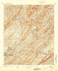
1907 Map of Leeds
USGS Topo · Published 1944About this map
Industrial development and the early iron industry anchor this early 20th-century survey of the Alabama ridge-and-valley landscape. The Lady Belle Furnace stands near Trussville, marking the era's heavy reliance on local mineral wealth, further evidenced by the Alfretta Mines tucked into the southern ridges. The complex terrain is defined by a series of parallel heights including Sand Mountain, Red Mountain, and Shades Mountain, which dictated the paths of the region's expanding rail network. Heavy hitters of the age like the Southern Ry, Central of Georgia Ry, and Birmingham Mineral RR crisscross the valleys to connect settlements like Leeds, Henryellen, and Mount Pinson Pinson P O. Local life is anchored by landmarks such as Oakgrove Church and Smiths Mill, while the Loves Mineral Well and McCluney Cave highlight the distinctive geological features of the Cahaba River basin.
Find a feature on this map
81 named features on this map. Tap any name to fly to it.
Don’t see what you’re looking for? This feature index may not catch every label — zoom into the map to look around manually.
Map Details
Editions of this 1907 Leeds Map
3 editions found

Other maps of this area

1889 · Springville
USGS Topo · 1:125,000

1889 · Birmingham
USGS Topo · 1:125,000

1890 · Bessemer
USGS Topo · 1:125,000

1890 · Talladega
USGS Topo · 1:125,000

1892 · Birmingham
USGS Topo · 1:125,000

1892 · Springville
USGS Topo · 1:125,000

1892 · Talladega
USGS Topo · 1:125,000

1892 · Bessemer
USGS Topo · 1:125,000

1895 · Birmingham
USGS Topo · 1:125,000

1904 · Birmingham Coal District
USGS Topo · 1:62,500