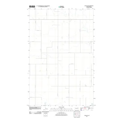
2011 Map of Leeds NE
USGS Topo · Published 2011About this map
Towner County's prairie landscape is defined by the rigid North Dakota Coordinate System grid, where roads like 73rd St NE and 60th Ave NE carve the terrain into predictable sections. This territory is characterized by numerous small, unorganized depressions and water bodies typical of the region's glacially-formed topography. The survey shows the modern road network at the start of the 2010s, including specialized routes like 60 1/2 Avenue NE and 65th Ave NE that provide access to isolated farmsteads and agricultural plots. The map traces the precise intersections of local thoroughfares such as 70th St NE and 63rd Ave NE, providing a clear record of rural land divisions and the infrastructure supporting this remote northern farming community.
Find a feature on this map
14 named features on this map. Tap any name to fly to it.
Don’t see what you’re looking for? This feature index may not catch every label — zoom into the map to look around manually.
Map Details
Editions of this 2011 Leeds NE Map
This is the sole edition of this map. No revisions or reprints were ever made.
Other maps of this area

1953 · Devils Lake
USGS Topo · 1:250,000

1956 · Devils Lake
USGS Topo · 1:250,000

1957 · Cando
USGS Topo · 1:24,000

1957 · Churchs Ferry
USGS Topo · 1:24,000

1962 · Egeland SW
USGS Topo · 1:24,000

1971 · Bisbee South
USGS Topo · 1:24,000

1971 · Considine
USGS Topo · 1:24,000

1971 · Leeds NE
USGS Topo · 1:24,000

1971 · Leeds
USGS Topo · 1:24,000
1971 · Hurricane Lake East
USGS Topo · 1:24,000