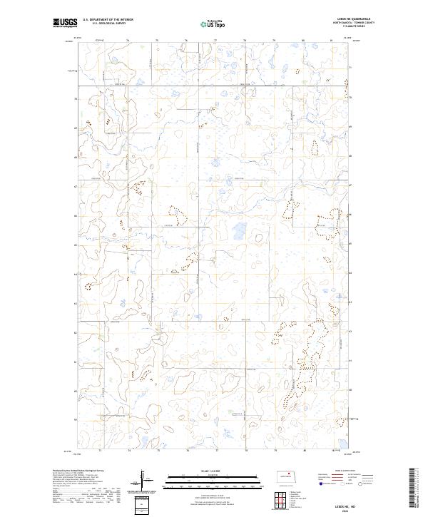
2024 Map of Leeds NE
USGS Topo · Published 2024About this map
The Towner County Waterfowl Production Area dominates the northern landscape of this North Dakota prairie region, representing a critical piece of the local ecosystem within the Prairie Pothole Region. This area of Towner County is characterized by a dense network of sectional roads, such as 74th St NE and 62nd Ave NE, which reflect the systematic organization of the Public Land Survey System across the Great Plains. The terrain is dotted with numerous small wetlands and depressions, traditional for this part of the state, which influenced the placement of rural corridors like 60 1/2 Ave NE. This modern survey illustrates how conservation land and agricultural access roads coexist in a region defined by its flat, water-checkered horizons and deliberate, grid-based development.
Find a feature on this map
20 named features on this map. Tap any name to fly to it.
Don’t see what you’re looking for? This feature index may not catch every label — zoom into the map to look around manually.
Map Details
Editions of this 2024 Leeds NE Map
This is the sole edition of this map. No revisions or reprints were ever made.
Other maps of this area

1953 · Devils Lake
USGS Topo · 1:250,000

1956 · Devils Lake
USGS Topo · 1:250,000

1957 · Cando
USGS Topo · 1:24,000

1957 · Churchs Ferry
USGS Topo · 1:24,000

1962 · Egeland SW
USGS Topo · 1:24,000

1971 · Bisbee South
USGS Topo · 1:24,000

1971 · Considine
USGS Topo · 1:24,000

1971 · Leeds NE
USGS Topo · 1:24,000

1971 · Leeds
USGS Topo · 1:24,000
1971 · Hurricane Lake East
USGS Topo · 1:24,000