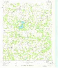
1960 Map of Leesburg
USGS Topo · Published 1962About this map
The Louisiana & Arkansas Railway cuts across the northern landscape of this East Texas region, connecting the settlement of Leesburg to the wider commercial networks of the early 1960s. The area is defined by its energy and recreational developments, notably the Newsome Oil Field and Pittsburg Oil Field, which underscore the industrial character of the era. Water features such as Ferndale Lake and the Ferndale Lake Club suggest a transition toward residential and leisure use amidst the working landscape.
Find a feature on this map
42 named features on this map. Tap any name to fly to it.
Don’t see what you’re looking for? This feature index may not catch every label — zoom into the map to look around manually.
Map Details
Editions of this 1960 Leesburg Map
2 editions found
Other maps of this area

1953 · Texarkana
USGS Topo · 1:250,000

1956 · Texarkana
USGS Topo · 1:250,000

1956 · Tyler
USGS Topo · 1:250,000

1960 · Bettie
USGS Topo · 1:24,000

1960 · Thomas
USGS Topo · 1:24,000

1960 · Newsome
USGS Topo · 1:24,000

1960 · Leesburg
USGS Topo · 1:24,000

1960 · Rhonesboro
USGS Topo · 1:24,000

1960 · Pittsburg
USGS Topo · 1:24,000

1964 · Harvard
USGS Topo · 1:24,000