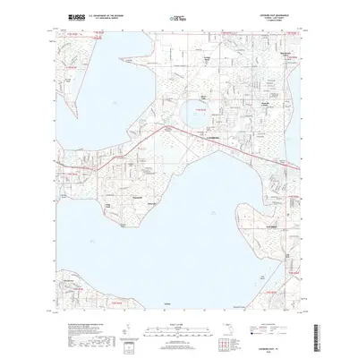
2018 Map of Leesburg East
USGS Topo · Published 2018About this map
Lake Harris and Lake Griffin dominate this central Florida landscape, framing the growth of Leesburg and Tavares. The area is defined by its complex hydrography, where the Palatlakaha River and Dead River connect a series of major lakes, creating numerous islands and points like Monkey Island and Johnsons Point. The map illustrates the transition from rural wetlands to established residential and educational centers, featuring Beacon College and the University of Central Florida Leesburg.
Find a feature on this map
181 named features on this map. Tap any name to fly to it.
Don’t see what you’re looking for? This feature index may not catch every label — zoom into the map to look around manually.
Map Details
Editions of this 2018 Leesburg East Map
This is the sole edition of this map. No revisions or reprints were ever made.
Other maps of this area

1955 · Orlando
USGS Topo · 1:250,000

1957 · Orlando
USGS Topo · 1:250,000

1958 · Orlando
USGS Topo · 1:250,000

1962 · Orlando
USGS Topo · 1:250,000

1962 · Astatula
USGS Topo · 1:24,000

1965 · Leesburg East
USGS Topo · 1:24,000

1965 · Umatilla
USGS Topo · 1:24,000

1966 · Leesburg West
USGS Topo · 1:24,000
1966 · Lady Lake
USGS Topo · 1:24,000
1966 · Eustis
USGS Topo · 1:24,000