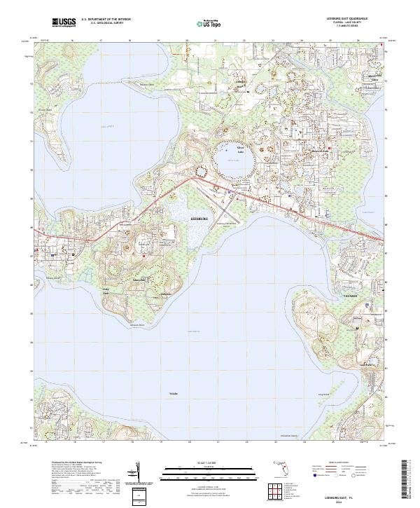
2024 Map of Leesburg East
USGS Topo · Published 2024About this map
Leesburg and the surrounding lake country of Florida define this landscape at the crossroads of water and rail. The city serves as a central hub, flanked by the waters of Lake Griffin, Lake Harris, and Lake Eustis, which are connected by a network of runs and creeks. The arrival of the CSX Transportation line and the presence of the Leesburg International Airport underscore the area's role as a regional transit and educational center, home to institutions like the University of Central Florida Leesburg and Lake-Sumter State College. Historical roots are evident in the numerous cemeteries scattered through the residential districts, including Shady Oak Cem and Lane Park Cem. Smaller communities such as Bassville Park, Sunnyside, and Tavares line the shorelines, while unique landforms like Treasure Island and Tomato Hill rise above the basin's edge.
Find a feature on this map
153 named features on this map. Tap any name to fly to it.
Don’t see what you’re looking for? This feature index may not catch every label — zoom into the map to look around manually.
Map Details
Editions of this 2024 Leesburg East Map
This is the sole edition of this map. No revisions or reprints were ever made.
Other maps of this area

1955 · Orlando
USGS Topo · 1:250,000

1957 · Orlando
USGS Topo · 1:250,000

1958 · Orlando
USGS Topo · 1:250,000

1962 · Orlando
USGS Topo · 1:250,000

1962 · Astatula
USGS Topo · 1:24,000

1965 · Leesburg East
USGS Topo · 1:24,000

1965 · Umatilla
USGS Topo · 1:24,000

1966 · Leesburg West
USGS Topo · 1:24,000
1966 · Lady Lake
USGS Topo · 1:24,000
1966 · Eustis
USGS Topo · 1:24,000