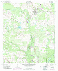
1973 Map of Leesburg
USGS Topo · Published 1988About this map
Kinchafoonee Creek meanders through the heart of Lee County, defining a landscape of agricultural lowlands and scattered rural settlements during the early 1970s. The county seat of Leesburg serves as the primary hub, where the Leesburg Cemetery and local institutions like Alpha Church anchor the community. Further south, the map documents the historical vicinity of Palmyra, featuring the Palmyra Cemetery and Palmyra Springs near the banks of the creek. The area's mid-century rural character is evident in the network of country churches and schools, such as Bethlehem-Lee Church and Upper School, while the southern reaches transition toward the recreational grounds of Chehaw City Park. This survey captures a moment of transition, showing traditional sites like Byne Crossroads alongside modern additions like various trailer parks and sewage disposal facilities.
Find a feature on this map
33 named features on this map. Tap any name to fly to it.
Don’t see what you’re looking for? This feature index may not catch every label — zoom into the map to look around manually.
Map Details
Editions of this 1973 Leesburg Map
2 editions found
Other maps of this area

1953 · Dothan
USGS Topo · 1:250,000

1954 · Dothan
USGS Topo · 1:250,000

1955 · Dothan
USGS Topo · 1:250,000

1956 · Albany East
USGS Topo · 1:24,000

1956 · Albany West
USGS Topo · 1:24,000

1956 · Sasser
USGS Topo · 1:62,500

1956 · Albany
USGS Topo · 1:62,500

1956 · Leslie
USGS Topo · 1:62,500

1973 · Sasser
USGS Topo · 1:24,000

1973 · Pretoria
USGS Topo · 1:24,000