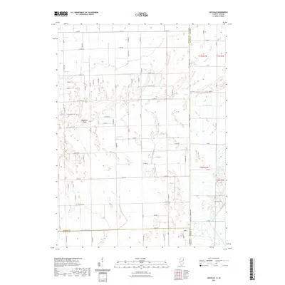
2021 Map of Leesville
USGS Topo · Published 2021About this map
Hopkins Park serves as a primary residential center within this landscape straddling the Illinois and Indiana border. The terrain is defined by an extensive network of drainage channels and small watercourses, including the central Little Beaver Cr and the northern Spring Cr. These waterways are supplemented by engineered features like Best Ditch, Redden Ditch, and River Houseworth Ditch, reflecting the historical efforts to manage the wetlands common to this region of Kankakee and Iroquois counties. Near the eastern state line, the Morgan Cem provides a specific point of interest for genealogical research. The road system follows a strict grid, with major local routes such as E 8000S Rd and Pennsylvania providing access across the low-lying agricultural and marshy lands that characterize this borderland area.
Find a feature on this map
46 named features on this map. Tap any name to fly to it.
Don’t see what you’re looking for? This feature index may not catch every label — zoom into the map to look around manually.
Map Details
Editions of this 2021 Leesville Map
This is the sole edition of this map. No revisions or reprints were ever made.
Other maps of this area

1922 · Momence
USGS Topo · 1:62,500

1924 · Momence
USGS Topo · 1:62,500

1935 · Watseka
USGS Topo · 1:48,000

1939 · Watseka
USGS Topo · 1:62,500

1953 · Chicago
USGS Topo · 1:250,000

1953 · Danville
USGS Topo · 1:250,000

1955 · Danville
USGS Topo · 1:250,000

1956 · Danville
USGS Topo · 1:250,000

1957 · Chicago
USGS Topo · 1:250,000

1959 · Schneider
USGS Topo · 1:24,000