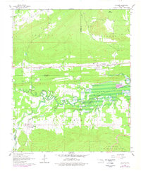
1965 Map of Leflore
USGS Topo · Published 1978About this map
The Leflore and Fanshawe settlements anchor this mid-1960s study of the Oklahoma landscape, revealing a region defined by the intersection of industrial development and riverine geography. Two major rail lines, the Chicago Rock Island and Pacific and the St Louis-San Francisco, traverse the terrain, reflecting the area's role as a transportation corridor. In the northern reaches, the Norris Gas Field and the Norris settlement signify the region's energy resources, while the presence of Hicks Chapel Cemetery and Hicks Chapel provide vital points of reference for local genealogy.
Find a feature on this map
26 named features on this map. Tap any name to fly to it.
Don’t see what you’re looking for? This feature index may not catch every label — zoom into the map to look around manually.
Map Details
Editions of this 1965 Leflore Map
2 editions found
Other maps of this area

1900 · Sansbois
USGS Topo · 1:125,000

1900 · Sallisaw
USGS Topo · 1:125,000

1900 · Winding Stair
USGS Topo · 1:125,000

1901 · Tuskahoma
USGS Topo · 1:125,000

1908 · Tuskahoma
USGS Topo · 1:125,000

1909 · Tuskahoma
USGS Topo · 1:125,000

1909 · Winding Stair
USGS Topo · 1:125,000

1909 · Sans Bois
USGS Topo · 1:125,000

1911 · Sallisaw
USGS Topo · 1:125,000

1911 · Sansbois
USGS Topo · 1:125,000