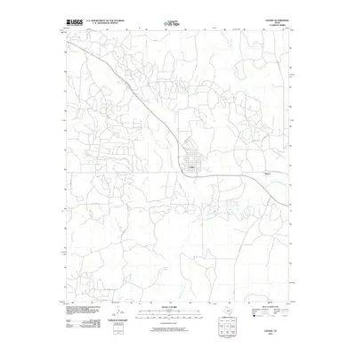
2010 Map of Lefors
USGS Topo · Published 2010About this map
Lefors sits at a geographic crossroads in the Texas Panhandle, positioned where the North Fork Red River begins its eastward bend. This 2010 survey illustrates a landscape defined by deeply etched drainage systems, including Thut Creek, Grapevine Creek, and Plum Creek, which converge toward the river valley. The grid of Lefors remains the primary hub of the area, while the smaller settlement of Wesco appears further east along Ranch Rd 1321.
Find a feature on this map
29 named features on this map. Tap any name to fly to it.
Don’t see what you’re looking for? This feature index may not catch every label — zoom into the map to look around manually.
Map Details
Editions of this 2010 Lefors Map
This is the sole edition of this map. No revisions or reprints were ever made.
Other maps of this area

1954 · Amarillo
USGS Topo · 1:250,000

1958 · Amarillo
USGS Topo · 1:250,000

1962 · Hudgens Ranch
USGS Topo · 1:24,000

1962 · Pond Creek NW
USGS Topo · 1:24,000

1963 · Pampa
USGS Topo · 1:24,000

1966 · Laketon
USGS Topo · 1:24,000

1966 · Bowers City
USGS Topo · 1:24,000

1967 · Lefors
USGS Topo · 1:24,000

1967 · Hoover
USGS Topo · 1:24,000

1968 · Taylor Ranch
USGS Topo · 1:24,000