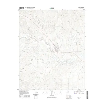
2016 Map of Lefors
USGS Topo · Published 2016About this map
The Lefors town site occupies a central position on this Texas Panhandle landscape, where the North Fork Red River creates a broad, meandering corridor. This mid-2010s survey details a high-plains environment defined by a dense network of seasonal drainages, including Plum Creek, Grapevine Creek, and Turkey Cr, all converging toward the river valley. The street grid of Lefors is clearly delineated, featuring a concentrated residential and civic core with thoroughfares like N Main St and E Thut St. Beyond the immediate settlement, the terrain is marked by a functional grid of rural roads such as Hog Farm Rd and Seminole Rd, reflecting the area's agricultural and ranching foundations. The map's contour lines illustrate the subtle but significant elevation changes as the tableland breaks into the draws and canyons of the Red River’s headwaters.
Find a feature on this map
50 named features on this map. Tap any name to fly to it.
Don’t see what you’re looking for? This feature index may not catch every label — zoom into the map to look around manually.
Map Details
Editions of this 2016 Lefors Map
This is the sole edition of this map. No revisions or reprints were ever made.
Other maps of this area

1954 · Amarillo
USGS Topo · 1:250,000

1958 · Amarillo
USGS Topo · 1:250,000

1962 · Hudgens Ranch
USGS Topo · 1:24,000

1962 · Pond Creek NW
USGS Topo · 1:24,000

1963 · Pampa
USGS Topo · 1:24,000

1966 · Laketon
USGS Topo · 1:24,000

1966 · Bowers City
USGS Topo · 1:24,000

1967 · Lefors
USGS Topo · 1:24,000

1967 · Hoover
USGS Topo · 1:24,000

1968 · Taylor Ranch
USGS Topo · 1:24,000