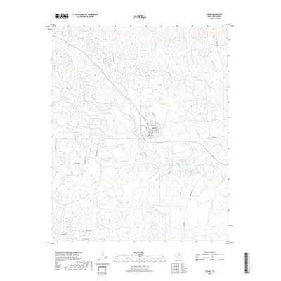
2019 Map of Lefors
USGS Topo · Published 2019About this map
Lefors sits at the heart of this Gray County landscape, where the town grid is defined by streets like N Main St and E Thut St. The geography is dominated by the winding course of the North Fork Red River, which cuts through the Texas Panhandle terrain alongside numerous tributary systems. Local drainage patterns are clearly marked by Plum Creek, Grapevine Creek, and Thut Creek, illustrating the hydraulic network that has shaped ranching and settlement in this part of the state. Outside the immediate town center, the landscape is crisscrossed by rural corridors such as Hog Farm Rd and Ranch Rd 1321, which connect isolated properties and ranch lands to the regional hub. The map provides a detailed view of the interaction between the area's watercourses, including Turkey Cr and Cabin Creek, and the local road network that supports the region's agricultural and ranching operations.
Find a feature on this map
46 named features on this map. Tap any name to fly to it.
Don’t see what you’re looking for? This feature index may not catch every label — zoom into the map to look around manually.
Map Details
Editions of this 2019 Lefors Map
This is the sole edition of this map. No revisions or reprints were ever made.
Other maps of this area

1954 · Amarillo
USGS Topo · 1:250,000

1958 · Amarillo
USGS Topo · 1:250,000

1962 · Hudgens Ranch
USGS Topo · 1:24,000

1962 · Pond Creek NW
USGS Topo · 1:24,000

1963 · Pampa
USGS Topo · 1:24,000

1966 · Laketon
USGS Topo · 1:24,000

1966 · Bowers City
USGS Topo · 1:24,000

1967 · Lefors
USGS Topo · 1:24,000

1967 · Hoover
USGS Topo · 1:24,000

1968 · Taylor Ranch
USGS Topo · 1:24,000