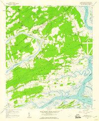
1959 Map of Legareville
USGS Topo · Published 1960About this map
Johns Island and the surrounding Sea Island landscape appear here during the late 1950s, defined by a network of tidal creeks and scattered rural settlements. The map highlights the localized community centers that anchored island life, from Fenwick Crossroads to the historic settlement of Legareville near the Stono River. The presence of Plowed Ground and a borrow pit near Miller Hill reflect the agricultural and early developmental shifts occurring just before Charleston's suburban expansion reached this far south.
Find a feature on this map
54 named features on this map. Tap any name to fly to it.
Don’t see what you’re looking for? This feature index may not catch every label — zoom into the map to look around manually.
Map Details
Editions of this 1959 Legareville Map
3 editions found
Other maps of this area

1918 · Kiawah Island
USGS Topo · 1:21,120

1919 · Johns Island
USGS Topo · 1:21,120

1919 · Wadmelaw Island
USGS Topo · 1:62,500

1919 · Charleston
USGS Topo · 1:21,120

1919 · James Island
USGS Topo · 1:21,120

1919 · Legareville
USGS Topo · 1:21,120

1920 · Ravenels
USGS Topo · 1:62,500

1943 · Legareville
USGS Topo · 1:24,000

1943 · James Island
USGS Topo · 1:24,000

1943 · Kiawah Island
USGS Topo · 1:24,000