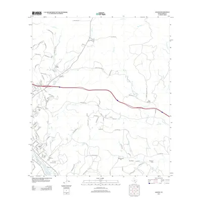
2012 Map of Legion
USGS Topo · Published 2012About this map
Legion serves as a focal point for this survey of the Texas Hill Country just east of Kerrville, where the suburban landscape meets the winding drainage of Cypress Cr and its numerous tributaries. The map documents a significant concentration of commemorative and civic sites, including the Kerrville National Cem, Garden of Memories Cem, and Tivy Mtn Cem. These sites, along with the Lions Camp for Crippled Children, reflect the area's long-standing institutional role in the community.
Find a feature on this map
100 named features on this map. Tap any name to fly to it.
Don’t see what you’re looking for? This feature index may not catch every label — zoom into the map to look around manually.
Map Details
Editions of this 2012 Legion Map
This is the sole edition of this map. No revisions or reprints were ever made.
Other maps of this area

1894 · Fredericksburg
USGS Topo · 1:125,000

1894 · Kerrville
USGS Topo · 1:125,000

1954 · Llano
USGS Topo · 1:250,000

1954 · San Antonio
USGS Topo · 1:250,000

1955 · Llano
USGS Topo · 1:250,000

1956 · Comfort
USGS Topo · 1:62,500

1956 · Center Point
USGS Topo · 1:62,500

1956 · Llano
USGS Topo · 1:250,000

1957 · San Antonio
USGS Topo · 1:250,000

1964 · Comfort
USGS Topo · 1:24,000