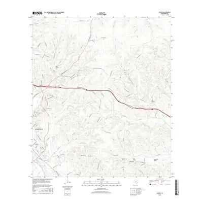
2016 Map of Legion
USGS Topo · Published 2016About this map
Kerrville and the nearby settlement of Legion anchor the southwestern portion of this landscape, where the waters of the Guadalupe River form Kerrville Lake. The terrain is defined by a series of narrow valleys and winding creeks, such as Quinlan Cr and Third Cr, that cut through the limestone hills. Genealogists will find several significant burial sites, including the Garden of Memories Cem and Brown Cem, while the local topography is punctuated by prominent rises like Tivy Mtn and Haddenbrock Hill.
Find a feature on this map
100 named features on this map. Tap any name to fly to it.
Don’t see what you’re looking for? This feature index may not catch every label — zoom into the map to look around manually.
Map Details
Editions of this 2016 Legion Map
This is the sole edition of this map. No revisions or reprints were ever made.
Other maps of this area

1894 · Fredericksburg
USGS Topo · 1:125,000

1894 · Kerrville
USGS Topo · 1:125,000

1954 · Llano
USGS Topo · 1:250,000

1954 · San Antonio
USGS Topo · 1:250,000

1955 · Llano
USGS Topo · 1:250,000

1956 · Comfort
USGS Topo · 1:62,500

1956 · Center Point
USGS Topo · 1:62,500

1956 · Llano
USGS Topo · 1:250,000

1957 · San Antonio
USGS Topo · 1:250,000

1964 · Comfort
USGS Topo · 1:24,000