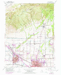
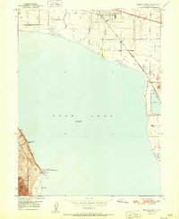
1951 Map of Lehi
USGS Topo · Published 1978About this map
Lehi and American Fork anchor this mid-century view of Utah County as the urban centers began their late-20th-century expansion. The landscape is defined by the sharp transition between the Traverse Mountains and the Wasatch Range to the north, and the valley floor where the Union Pacific and Denver and Rio Grande Western railroads intersect. This period illustrates a complex hydraulic infrastructure, showcasing the Provo Reservoir Canal and the Salt Lake City Aqueduct as they snake across the benchlands to support growing settlements. Local history is deeply embedded in landmarks like Margaret Wines Park and the Alpine Cemetery, while smaller outposts like Manila and the Highland Church indicate the rural character that preceded the suburban sprawl. The map captures the vital connection between the mountain watersheds, such as Dry Creek and Hog Hollow, and the industrial and agricultural life centered around the Mill Pond.
Find a feature on this map
55 named features on this map. Tap any name to fly to it.
Don’t see what you’re looking for? This feature index may not catch every label — zoom into the map to look around manually.
Map Details
Editions of this 1951 Lehi Map
5 editions found

Other maps of this area

1885 · Salt Lake
USGS Topo · 1:250,000

1925 · Ft. Douglas
USGS Topo · 1:125,000

1928 · Ft. Douglas
USGS Topo · 1:125,000

1948 · Timpanogos Cave
USGS Topo · 1:24,000

1948 · Orem
USGS Topo · 1:24,000

1948 · Orem
USGS Topo · 1:62,500

1950 · Orem
USGS Topo · 1:24,000

1950 · Timpanogos Cave
USGS Topo · 1:24,000

1950 · Pelican Point
USGS Topo · 1:24,000
1951 · Pelican Point
USGS Topo · 1:24,000