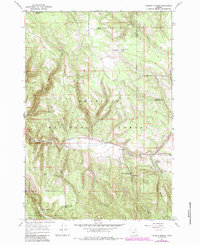
1967 Map of Lehman Springs
USGS Topo · Published 1984About this map
Lehman Springs serves as the focal point of this highland survey, situated at the confluence of several vital water sources and thermal activity. The area is defined by the heavy presence of natural springs, including Hot Spring, Lehman Spring, and Bear Wallow Spring, which likely supported early settlement and seasonal grazing. The landscape transitions between the Wallowa-Whitman National Forest and the Umatilla National Forest, following the winding course of Camas Creek and its many tributaries.
Find a feature on this map
28 named features on this map. Tap any name to fly to it.
Don’t see what you’re looking for? This feature index may not catch every label — zoom into the map to look around manually.
Map Details
Editions of this 1967 Lehman Springs Map
2 editions found
Other maps of this area

1953 · Pendleton
USGS Topo · 1:250,000

1956 · Pendleton
USGS Topo · 1:250,000

1967 · Ukiah SE
USGS Topo · 1:24,000

1967 · Tower Mtn
USGS Topo · 1:24,000

1967 · Sullivan Gulch
USGS Topo · 1:24,000

1967 · Lehman Springs
USGS Topo · 1:24,000

1967 · Granite Meadows
USGS Topo · 1:24,000

1967 · Bally Mountain
USGS Topo · 1:24,000

1967 · Pearson Ridge
USGS Topo · 1:24,000

1967 · Owens Butte
USGS Topo · 1:24,000