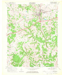
1967 Map of Leitchfield
USGS Topo · Published 1969About this map
The county seat of Leitchfield anchors this mid-century landscape, positioned at a critical junction where the Illinois Central Railroad and the Western Kentucky Parkway intersect. The terrain transitions from the developed grid of the town to the complex drainage systems of Bear Creek and McClure Fork to the south. Small rural communities like Black Rock and Blowtown are scattered throughout the quadrangle, connected by older routes such as Central Road.
Find a feature on this map
46 named features on this map. Tap any name to fly to it.
Don’t see what you’re looking for? This feature index may not catch every label — zoom into the map to look around manually.
Map Details
Editions of this 1967 Leitchfield Map
2 editions found
Other maps of this area

1922 · Leitchfield
USGS Topo · 1:48,000

1925 · Cub Run
USGS Topo · 1:62,500

1925 · Leitchfield
USGS Topo · 1:62,500

1932 · Big Clifty
USGS Topo · 1:62,500

1949 · Big Clifty
USGS Topo · 1:24,000

1949 · Big Clifty
USGS Topo · 1:62,500

1953 · Mc Daniels
USGS Topo · 1:24,000

1953 · Ready
USGS Topo · 1:24,000

1953 · Bee Spring
USGS Topo · 1:24,000

1954 · Evansville
USGS Topo · 1:250,000