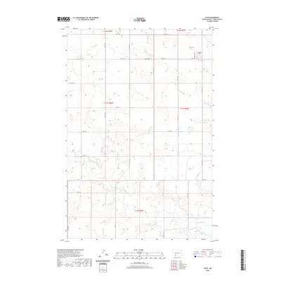
2020 Map of Leith
USGS Topo · Published 2020About this map
The Cannonball River meanders across the southern plains of Grant County, anchoring a landscape shaped by rural section lines and deep-cut drainage coulees. The small settlement of Leith sits at the northern edge of this survey, serving as a focal point for the surrounding agricultural community. To the north of the town, Leith Cem provides a point of interest for genealogists tracing local family history. The topography is defined by significant elevations like Spring Hill, which rises above the drainages of Boxelder Cr and Morris Cr. This contemporary survey reflects the enduring grid of the Public Land Survey System, showing how the original township divisions—including t133n r88w and t134n r87w—continue to dictate the modern road network and land use patterns in this part of North Dakota.
Find a feature on this map
19 named features on this map. Tap any name to fly to it.
Don’t see what you’re looking for? This feature index may not catch every label — zoom into the map to look around manually.
Map Details
Editions of this 2020 Leith Map
This is the sole edition of this map. No revisions or reprints were ever made.
Other maps of this area

1954 · Bismarck
USGS Topo · 1:250,000

1958 · Bismarck
USGS Topo · 1:250,000

1972 · Carson SE
USGS Topo · 1:24,000

1972 · Leith
USGS Topo · 1:24,000

1972 · Paradise Flats
USGS Topo · 1:24,000

1972 · Wheeler Hills
USGS Topo · 1:24,000

1972 · Pretty Rock Butte
USGS Topo · 1:24,000

1972 · Sheep Creek Dam
USGS Topo · 1:24,000

1980 · Heil
USGS Topo · 1:24,000
1980 · Elgin
USGS Topo · 1:24,000