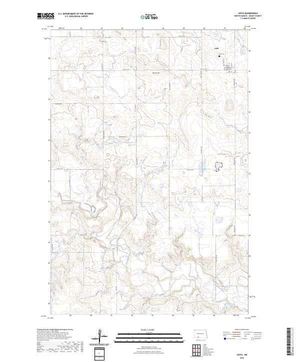
2024 Map of Leith
USGS Topo · Published 2024About this map
The small prairie community of Leith sits at the northern edge of this Grant County survey, characterized by a deliberate grid of section-line roads cutting across the drainage basins of the Missouri River plateau. The landscape is defined by the winding course of the Cannonball River as it snakes through the southern half of the quadrangle, joined by tributaries like Boxelder Creek and Morris Creek. Local landmarks such as Spring Hill rise above the surrounding terrain, providing a sense of the relief that historically influenced the placement of early homesteads and grazing lands. Genealogists and researchers will find the Leith Cem clearly marked at the edge of town near Main Ave, providing a specific coordinate for family history research in this rural portion of the state. The layout of rural routes like Heil Rd and numerous numbered streets reflects the late 20th-century development of the region's transport network.
Find a feature on this map
27 named features on this map. Tap any name to fly to it.
Don’t see what you’re looking for? This feature index may not catch every label — zoom into the map to look around manually.
Map Details
Editions of this 2024 Leith Map
This is the sole edition of this map. No revisions or reprints were ever made.
Other maps of this area

1954 · Bismarck
USGS Topo · 1:250,000

1958 · Bismarck
USGS Topo · 1:250,000

1972 · Carson SE
USGS Topo · 1:24,000

1972 · Leith
USGS Topo · 1:24,000

1972 · Paradise Flats
USGS Topo · 1:24,000

1972 · Wheeler Hills
USGS Topo · 1:24,000

1972 · Pretty Rock Butte
USGS Topo · 1:24,000

1972 · Sheep Creek Dam
USGS Topo · 1:24,000

1980 · Heil
USGS Topo · 1:24,000
1980 · Elgin
USGS Topo · 1:24,000