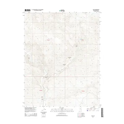
2014 Map of Leith
USGS Topo · Published 2014About this map
Meadow Valley Wash defines the north-south axis of this eastern Nevada landscape, creating a vital corridor through the high desert of Lincoln County. The small settlements of Kyle and Leith appear as distinct markers along this drainage, with Carp Rd providing the primary overland connection through the valley. The map reveals a complex network of canyons and springs that sustained life in this arid region, from the seasonal flows of Coldwater Cr to hidden water sources like Fountain of Youth Spring and Mudhole Spring. Topographically, the area is divided into significant landforms such as Long Valley and Cottonwood Canyon, reflecting the rugged geologic character of the Mormon Mountains vicinity. The inclusion of named features like Horse Pasture Canyon and Cougar Canyon highlights the area's history as rangeland where water and terrain dictated the patterns of human movement and settlement.
Find a feature on this map
18 named features on this map. Tap any name to fly to it.
Don’t see what you’re looking for? This feature index may not catch every label — zoom into the map to look around manually.
Map Details
Editions of this 2014 Leith Map
This is the sole edition of this map. No revisions or reprints were ever made.
Other maps of this area

1885 · Pioche
USGS Topo · 1:250,000

1886 · Pioche
USGS Topo · 1:250,000

1954 · Caliente
USGS Topo · 1:250,000

1959 · Caliente
USGS Topo · 1:250,000

1969 · Elgin
USGS Topo · 1:24,000

1969 · Elgin NE
USGS Topo · 1:24,000
1969 · Vigo NE
USGS Topo · 1:24,000

1973 · Ella Mountain
USGS Topo · 1:24,000
1973 · Leith
USGS Topo · 1:24,000
1973 · Blue Nose Peak
USGS Topo · 1:24,000