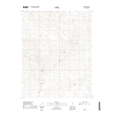
2018 Map of Leith
USGS Topo · Published 2018About this map
Meadow Valley Wash defines the western corridor of this Lincoln County landscape, serving as a primary hydrological and transit artery through the high desert. The small settlements of Kyle and Leith are positioned along this waterway, where the terrain breaks into a complex system of drainage channels and canyons. These canyon systems, including Leith Canyon, Cottonwood Canyon, and Horse Springs Canyon, illustrate the erosional patterns of the region's dry washes. Water access in this arid environment is localized at named points such as Oil Spring, Mudhole Spring, and the evocatively named Fountain of Youth Spring near the eastern boundary. The presence of Carp RD and CO Rte 4230 suggests the continued importance of these historical transit routes through the rugged Basin and Range geography.
Find a feature on this map
19 named features on this map. Tap any name to fly to it.
Don’t see what you’re looking for? This feature index may not catch every label — zoom into the map to look around manually.
Map Details
Editions of this 2018 Leith Map
This is the sole edition of this map. No revisions or reprints were ever made.
Other maps of this area

1885 · Pioche
USGS Topo · 1:250,000

1886 · Pioche
USGS Topo · 1:250,000

1954 · Caliente
USGS Topo · 1:250,000

1959 · Caliente
USGS Topo · 1:250,000

1969 · Elgin
USGS Topo · 1:24,000

1969 · Elgin NE
USGS Topo · 1:24,000
1969 · Vigo NE
USGS Topo · 1:24,000

1973 · Ella Mountain
USGS Topo · 1:24,000
1973 · Leith
USGS Topo · 1:24,000
1973 · Blue Nose Peak
USGS Topo · 1:24,000