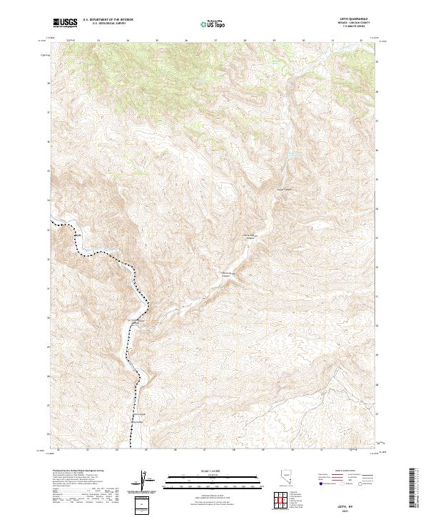
2021 Map of Leith
USGS Topo · Published 2021About this map
Meadow Valley Wash winds through this arid section of Lincoln County, defining the drainage patterns that shaped the local geography. Near the water's edge, the small settlement of Kyle sits at the base of the surrounding plateaus. The landscape is deeply incised by a network of drainage features, including Horse Pasture Canyon, Horse Springs Canyon, and Cottonwood Canyon. These natural corridors have historically dictated movement through the basin-and-range topography. Water remains a critical element for navigation and land use in this desert environment, marked by several named points such as Oil Spring, Mudhole Spring, and the optimistically named Fountain of (Youth Spring). To the south, Leith Canyon and Long Valley provide further definition to the complex terrain accessed by Carp Rd and Co Rte 4230.
Find a feature on this map
18 named features on this map. Tap any name to fly to it.
Don’t see what you’re looking for? This feature index may not catch every label — zoom into the map to look around manually.
Map Details
Editions of this 2021 Leith Map
This is the sole edition of this map. No revisions or reprints were ever made.
Other maps of this area

1885 · Pioche
USGS Topo · 1:250,000

1886 · Pioche
USGS Topo · 1:250,000

1954 · Caliente
USGS Topo · 1:250,000

1959 · Caliente
USGS Topo · 1:250,000

1969 · Elgin
USGS Topo · 1:24,000

1969 · Elgin NE
USGS Topo · 1:24,000
1969 · Vigo NE
USGS Topo · 1:24,000

1973 · Ella Mountain
USGS Topo · 1:24,000
1973 · Leith
USGS Topo · 1:24,000
1973 · Blue Nose Peak
USGS Topo · 1:24,000