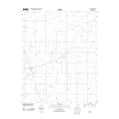
2012 Map of Lela
USGS Topo · Published 2012About this map
Black Bear Creek meanders across this rural section of Oklahoma, defining a landscape shaped by tributary drainage and modern water management. The small settlement of Lela serves as a central point, supported by a network of sectional roads and the larger Lower Black Bear Creek Site 14 Reservoir. For genealogists, the map is particularly useful for locating several distinct burial grounds, including Lela Cem, Union Cem, and the Indian Cem, each positioned near the winding paths of Lion Creek and its neighboring branches.
Find a feature on this map
40 named features on this map. Tap any name to fly to it.
Don’t see what you’re looking for? This feature index may not catch every label — zoom into the map to look around manually.
Map Details
Editions of this 2012 Lela Map
This is the sole edition of this map. No revisions or reprints were ever made.
Other maps of this area

1893 · Stillwater
USGS Topo · 1:62,500

1929 · Ripley
USGS Topo · 1:62,500

1930 · Pawnee
USGS Topo · 1:62,500

1932 · Ripley
USGS Topo · 1:62,500

1936 · Pawnee
USGS Topo · 1:62,500

1955 · Enid
USGS Topo · 1:250,000

1958 · Enid
USGS Topo · 1:250,000
1967 · Stillwater North
USGS Topo · 1:24,000

1972 · Morrison NE
USGS Topo · 1:24,000

1972 · Morrison
USGS Topo · 1:24,000