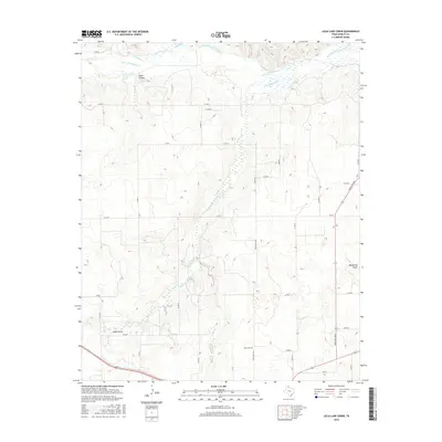
2016 Map of Lelia Lake Creek
USGS Topo · Published 2016About this map
Salt Fork Red River defines the northern edge of this high plains landscape, where complex drainage systems cut through the Donley County terrain. The survey captures a network of intermittent watercourses and topographic depressions that reveal the area's hydrology, including the eponymous Lelia Lake Creek and the notable Eagle Arroyo. These natural features, alongside Oklahoma Draw and Kilfoil Draw, dictate the placement of local infrastructure and land use patterns in this part of the Texas Panhandle.
Find a feature on this map
21 named features on this map. Tap any name to fly to it.
Don’t see what you’re looking for? This feature index may not catch every label — zoom into the map to look around manually.
Map Details
Editions of this 2016 Lelia Lake Creek Map
This is the sole edition of this map. No revisions or reprints were ever made.
Other maps of this area

1954 · Amarillo
USGS Topo · 1:250,000

1954 · Plainview
USGS Topo · 1:250,000

1958 · Amarillo
USGS Topo · 1:250,000

1958 · Plainview
USGS Topo · 1:250,000

1959 · Lelia Lake Creek
USGS Topo · 1:24,000

1959 · Troublesome Creek
USGS Topo · 1:24,000

1959 · Spencer Lake
USGS Topo · 1:24,000

1959 · McKnight
USGS Topo · 1:24,000

1962 · Lelia Lake
USGS Topo · 1:24,000

1962 · Griffin Ranch
USGS Topo · 1:24,000