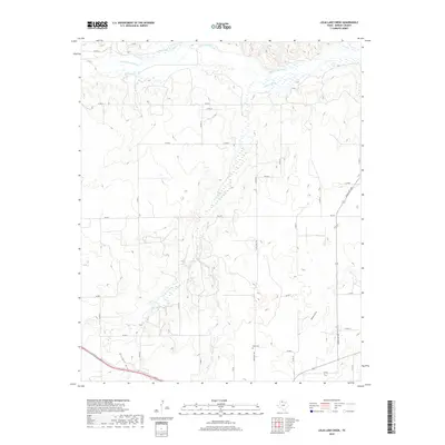
2019 Map of Lelia Lake Creek
USGS Topo · Published 2019About this map
The Salt Fork Red River defines the northern edge of this Panhandle landscape, where a network of seasonal drainages and creek beds cuts through the Donley County plains. The terrain is deeply textured by erosion, most notably seen in the winding paths of Lelia Lake Cr, Bell Creek, and the distinct topographic depressions of Kilfoll Draw and Oklahoma Draw. This 2019 survey documents a sparsely populated ranching and agricultural region, where local history is anchored at the Rowe Cem along Ranch RD 1932. The map details the modern transition of the land, showing how state routes like FM 2471 and various county roads, including Co RD M and Co RD O, navigate the breaks and draws that feed into the Red River system.
Find a feature on this map
32 named features on this map. Tap any name to fly to it.
Don’t see what you’re looking for? This feature index may not catch every label — zoom into the map to look around manually.
Map Details
Editions of this 2019 Lelia Lake Creek Map
This is the sole edition of this map. No revisions or reprints were ever made.
Other maps of this area

1954 · Amarillo
USGS Topo · 1:250,000

1954 · Plainview
USGS Topo · 1:250,000

1958 · Amarillo
USGS Topo · 1:250,000

1958 · Plainview
USGS Topo · 1:250,000

1959 · Lelia Lake Creek
USGS Topo · 1:24,000

1959 · Troublesome Creek
USGS Topo · 1:24,000

1959 · Spencer Lake
USGS Topo · 1:24,000

1959 · McKnight
USGS Topo · 1:24,000

1962 · Lelia Lake
USGS Topo · 1:24,000

1962 · Griffin Ranch
USGS Topo · 1:24,000