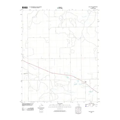
2010 Map of Lelia Lake
USGS Topo · Published 2010About this map
Salt Fork Red River flows through the northern reaches of this Donley County landscape, where the high plains of the Texas Panhandle transition into a network of vital water sources. The small community of Lelia Lake sits toward the southeast, positioned near its namesake water body and the marshes of Cattail Lake. This area is defined by its agricultural and hydrological character, with drainage systems like West Lelia Lake Creek and Saddlers Creek carving through the terrain. To the west, the Clarendon Municipal Airport serves as a modern landmark for the nearby county seat. The map reveals an intricate grid of county roads and ranch routes, such as Ranch Rd 1754 and Co Rd 13, which facilitate movement between scattered farmsteads and local basins like Johnson Lake and Taylor Lakes.
Find a feature on this map
31 named features on this map. Tap any name to fly to it.
Don’t see what you’re looking for? This feature index may not catch every label — zoom into the map to look around manually.
Map Details
Editions of this 2010 Lelia Lake Map
This is the sole edition of this map. No revisions or reprints were ever made.
Other maps of this area

1954 · Amarillo
USGS Topo · 1:250,000

1954 · Plainview
USGS Topo · 1:250,000

1958 · Amarillo
USGS Topo · 1:250,000

1958 · Plainview
USGS Topo · 1:250,000

1959 · Lelia Lake Creek
USGS Topo · 1:24,000

1959 · Troublesome Creek
USGS Topo · 1:24,000

1962 · Lelia Lake
USGS Topo · 1:24,000

1962 · Roach Ranch
USGS Topo · 1:24,000

1962 · Griffin Ranch
USGS Topo · 1:24,000

1963 · Hedley
USGS Topo · 1:24,000